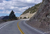
 ANGELES CREST HIGHWAY  WRIGHTWOOD SNOW PLAY  MH SLEDS 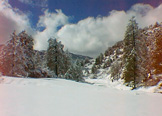 OUTDOOR REPORT 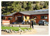 MOUNTAIN HARDWARE |
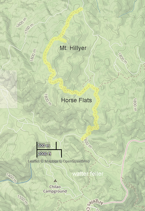
Hike WrightwoodChilao to Mt. Hillyer via Horse Flats3 miles one way.Elevation gain: 1,000 feet Difficulty: Moderate Topo Map: Chilao Flat If parking anyplace other than the Visitor Center, or in your camp site parking space within the campground, a National Forest Adventure Pass is required to be displayed on vehicles parked while visitors are hiking. The first mile from upper Chilao Campground to Horse Flats is a fine trail through chaparral and some pine. The trail is exposed to the sun, so take along water during summer. During the spring and early summer, look for the exotic snow plant, looking like a large, red spear of asparagus. Magnificent specimens of Yucca are in bloom at this time of year, as well as Ceanothus (also known as Mountain Lilac) and Mountain Mahogany. From Horse Flats bear left and you will pass through an open forest of Jeffrey and Ponderosa Pine, as well as Manzanita and oak interspersed with huge boulder outcroppings. The top is so forested and flat, you can’t see out much until you walk a few hundred feet southwest out on a ridge. From there you look out over the Chilao area and down into the Alder Creek branch of Tujunga Canyon. Many mountain peaks may also be seen, including Vetter and Pacifico. From the Angeles Crest Highway, take the upper Chilao Campground Road for about 3/4 mile (you will pass the Visitor Center). Park in the paved parking spaces, take the trail to your right, which is the Horse Flats Trail (this is part of the Silver Moccasin Trail). After a mile of climbing, you will come to a dirt road at the edge of Horse Flats. Go a short distance to a sign which is on the left to Mt. Hillyer, 2 miles by trail. You can eliminate a couple of miles hiking on the round trip (although you’ll miss some interesting trail) by driving directly to Horse Flats and hiking up from the dirt road just described, at the edge of the campground. A still easier route to Mt. Hillyer, and a good one for beginners, is to drive to the end of the north spur road and hike 3/4 mile to the top. Although only a 300 ft. elevation gain, it is steep at first but almost level the last 1/2 mile. To take this route, drive about 2 miles past Chilao on the Angeles Crest Highway to Three Points and take the Santa Clara Divide Road about 1/2 mile to the left to Horse Flats. Go past Horse Flats Campground entrance to a small dirt parking area to the left. Follow this ridge south 1/2 mile; follow any of several steep paths up the hillside to the ridge top, and then follow the ridge up to the highest point. With a car shuttle, you can go one way and return another. chilao-mt.hillyertrail.html Tom Chester & Jane Strong -- http://tchester.org/ |
|