Middle Fork Trailhead
The Middle Fork Trailhead is accessible via the Middle Fork Road, Forest Road 2N58. This road leaves the Lytle Creek Road about 2 miles above the Lytle Creek Ranger Station. The Middle Fork Road is unpaved and high-clearance vehicles are required to reach the trailhead. 4WD may also be required. This road is generally open year-round, but occasionally heavy rains and snow can close it. Snow is often present on the trail in the winter months. Please call the Lytle Creek Ranger Station (909) 382-2851 for current road and trail conditions.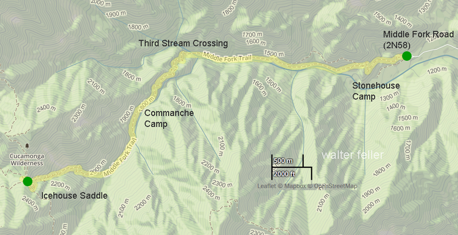
The trail climbs steeply for the first 1/2 mile and is unshaded. At the top of the ridge the trail splits (unsigned trail junction). The lower trail leads to Stonehouse Camp and is not maintained any further.
The upper trail contours around a steep rocky hillside, crosses a small seasonal stream, then leads further to the Cucamonga Wilderness Boundary sign. Here the trail becomes more shaded. Shortly before Third Stream Crossing Camp hikers will have to cross the creek (2.3 miles from trailhead). After Third Stream Crossing the trail switchbacks up to Comanche Camp (3.8 miles from trailhead), and eventually reaches Icehouse Saddle (5.5 miles from trailhead). Total elevation gain from the trailhead to Icehouse Saddle is 3,600 feet.
Once at the saddle hikers can choose to hike up Cucamonga Peak and/or Ontario Peak, over to the Three T's (Timber, Telegraph, and Thunder Peaks), or hike down to the Icehouse Trailhead on the Angeles National Forest.
middle-fork-trail.html
USDA - USFS
