 ANGELES CREST HIGHWAY  WRIGHTWOOD SNOW PLAY  MH SLEDS 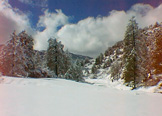 OUTDOOR REPORT  MOUNTAIN HARDWARE |
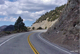
Hike WrightwoodThree Points to Twin Peaks Saddle, Mt. Waterman & Buckhorn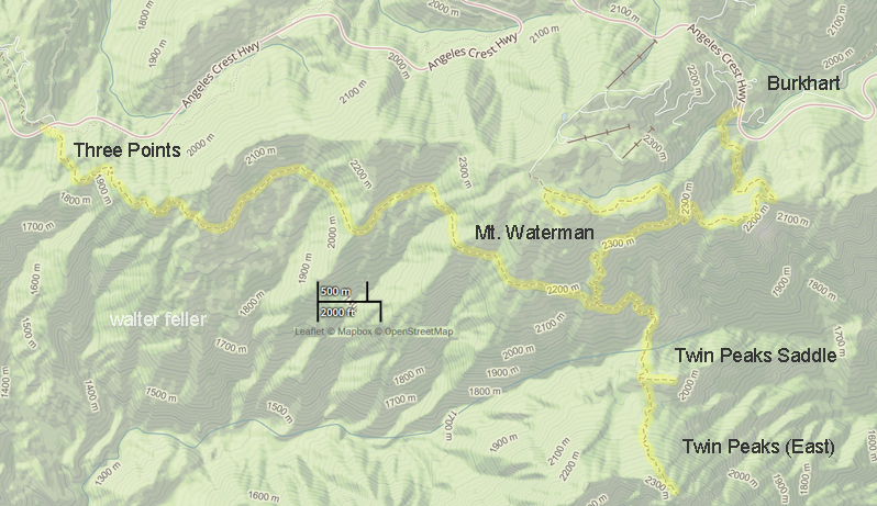 11.8 miles total. Elevation gain: 3,700 feet Difficulty: Strenuous Topo Map: Waterman Mountain This is a beautiful hike through some of the finest Angeles National Forest high country. It is a long, arduous hike, but you can see much of this scenic area by only going part way and then turning back. Most of the trip is through dense forests of pine, fir, cedar, mountain mahogany and some oak. The scenic views are outstanding, especially from the easternmost summit of Twin Peaks. From there, you can look over most of the rugged San Gabriel Wilderness area, including Bear Creek and Devil’s Canyon. By keeping a sharp watch, you may see some of the Bighorn Sheep inhabiting the area. The six mile segment between Three Points and Waterman-Twin Peaks trail junction is at its best during spring and early summer, before the small steams along the way dry up and while flowers are blooming in miniature meadows. Drive about two miles past Chilao on the Angeles Crest Highway to Three Points. Three Points is not marked, but is where the Santa Clara Divide Road to Horse Flats leaves the Angeles Crest Highway on your left. A National Forest Adventure Pass is required to be displayed on your vehicle while parked at the trailhead. The trail starts across the highway from the Horse Flats road. It soon passes two junctions. Take the left branch at the first junction, and the right branch at the second. Follow the Mt. Waterman signs. The trail switchbacks up for the first mile, then levels off and winds in and out of little ravines across the western slopes of Mt. Waterman another four miles to Twin Peaks junction. The right fork goes one mile to the saddle between Mt. Waterman and Twin Peaks, a lovely parklike area containing the finest grove of large cedar trees in the Angeles. The left fork goes to Mt. Waterman and Buckhorn. There is no maintained trail to Twin Peaks. Follow a very steep path worn by hikers from the saddle to the easternmost (highest) peak of the twins. Elevation is 7,760 or about 1,200 feet higher than the saddle. Return by the same route or take the trail at the junction to Mt. Waterman and Buckhorn, if you can arrange a car shuttle. The trip is mostly within the San Gabriel Wilderness Area. A National Forest Adventure Pass is required for your vehicle while parked at the trailhead. threepts-twinpeakstrail.html Tom Chester & Jane Strong -- http://tchester.org/ |
|