 ANGELES CREST HIGHWAY  WRIGHTWOOD SNOW PLAY  MH SLEDS  OUTDOOR REPORT  MOUNTAIN HARDWARE |
Hike WrightwoodBuckhorn to Cooper Canyon & Littlerock Creek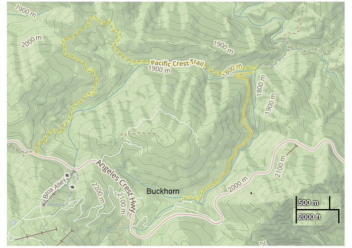 2.2 miles one way Elevation Change: 900 feet Difficulty: Moderate Topo Map: Mt. Waterman This hike takes you through some of the most beautiful country of the San Gabriel Mountains. Starting at Buckhorn Campground, the trail descends through a forest of pine, fir and cedar, with alders along nearby Buckhorn Creek. A short distance down, the trail passes through a small thicket of wild rose bushes at the edge of a muddy patch kept wet by a small spring. In spring and summer, you may see a few dainty rose blooms. During June and July, exotic blooms of Lemon Lily may be seen near streams in this area. Many birds, including Red-shafted Flickers, are seen in this area. Two miles down, the trail forks at Cooper Canyon. The left fork goes up through lovely Cooper Canyon to Cooper Campground (1.2 miles), and 1.75 more miles up a dirt fire road to Angeles Crest Highway at Cloudburst Summit. You can hike back down the highway 2 more miles to your car at Buckhorn. The right fork at the trail junction takes you down through Cooper Canyon, past Cooper Falls, to Littlerock Creek and another junction (0.3 miles). From here, return the way you came, or take any of three options. Follow the trail left to Burkhart Saddle on the Burkhart Trail (3.5 miles). From there you can go left to Pleasant View Ridge and Will Thrall Peak, or continue across the Saddle and down to Devilís Punchbowl. Both of these alternatives are through fine forested country with magnificent views, but are long hikes and should not be attempted unless you are an experienced hiker in good condition. A right at the Littlerock Creek junction will take you a beautiful 3.5 miles up to Eagles Roost picnic ground beside Angeles Crest Highway, 4 miles east of Buckhorn by highway. It is also possible to travel down Littlerock Creek by boulder-hopping, but there is no trail so donít go alone. There is some trout fishing in Littlerock Creek. For those who want a shorter hike, go only to the junction at Big Rock, for a 4.4. mile round-trip. Even though itís all uphill back to Buckhorn, this is a very rewarding hike. Donít overdo it, and you will come back refreshed and enriched. Follow Angeles Crest Highway to Buckhorn Campground, about 8 miles past Chilao. Park in the hikerís parking lot at the end of a side road to the right about halfway down through the campground. Donít park in any of the campsite spurs. The trail is easily found on the left side of Buckhorn Creek, at the north end of the trailhead parking. If you are not camping at Buckhorn Campground, a National Forest Adventure Pass is required for vehicles parked at the Trailhead. buckhorn-coopertrail.html |
|
