 ANGELES CREST HIGHWAY  WRIGHTWOOD SNOW PLAY  MH SLEDS 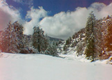 OUTDOOR REPORT  MOUNTAIN HARDWARE |
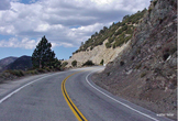
Hike WrightwoodEagles Roost to Littlerock Creek7 miles round tripElevation change: 1,100 feet Difficulty: Moderate Topo Map: Mt. Waterman 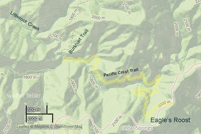 This trail passes through some of the most beautiful forested areas of the San Gabriel Mountains. The trail starts across the highway from Eagles Roost Picnic Area, which is located along the Angeles Crest Highway 4 miles east of Buckhorn, and about 37 miles from La Canada. Park at the picnic area just west of a large brown highway maintenance building. (Don’t forget that a National Forest Adventure Pass is required for your vehicle while parked at the trailhead). Look for an old logging road descending in a westerly direction on the north side of the highway. There is no sign. Follow this road down about .75 mile and watch for a trail that takes off from the road to your right. It descends steeply at first and then levels out to a gently downhill grade. Within another .25 mile or so, through a lush forest of pine, fir, cedar and oak, you will come to a small stream. This is the upper part of Littlerock Creek. For a short hike, make this your destination, and after exploring upstream past a magnificent group of cedar trees to a tiny waterfall, return the way you came. Remember - it’s all uphill to get back to the highway. There are spectacular views of varicolored rocky cliffs and outcroppings along the way. If you want more of a hike, continue on down the trail another 2.5 miles to the main part of Littlerock Creek. There you will intersect the Burkhart Trail. For a moderate hike, return from this point after exploring the beautiful stream and nearby falls. For a strenuous hike, a right turn at the trail junction will take you to Burkhart Saddle (3.5 miles), Pleasant View Ridge, and even on to the desert. While very scenic, this is a long, hard trip. A left turn at the same junction will take you to Buckhorn Campground, about 2.2 more miles. From Buckhorn you can return the way you came, or take the exit road from the campground back up to the highway, and hike 4 miles back along the highway to your car at Eagles Roost. The first part of the trail, from Eagles Roost down into Littlerock Canyon, is known as the Rattlesnake Trail. This trail is also part of the Silver Moccasin Trail and the Pacific Crest Trail. There is also another “Rattlesnake Trail” on the north side of Mt. Wilson. eaglesroost-littlerocktrl.html Tom Chester & Jane Strong -- http://tchester.org/ |
|